TRAFFIC · DATA · CODE

Liang
Chen

Transportation Modeler / Data Analyst, AICP Traffic & revenue · Web & AI builder

Transportation modeler and data analyst with 8 years in traffic forecasting, travel demand modeling, and traffic operations and safety. I build toll diversion models that forecast how many drivers will choose an express lane or toll road. A planner at heart, I build AI-powered tools that put the vast pool of transportation data to work for people — and use data to help more people care about how our cities are planned.

FEATURED · VIDEO

SIDE PROJECT · CORNERSCORE

How livable is every square kilometer of urban Dallas–Fort Worth?

6,213 hexes covering the Census Dallas–Fort Worth–Arlington urban area, each scored on groceries, coffee, parks, walkable centers and transit.

SIDE PROJECT · TEXAS CRASH DATA

When do Texans crash? 1.9 million crashes, 2023–2025, by hour of the week.

  1. Weekday rush. Friday 4 PM is the worst hour of the week.
  2. Weekend 2 AM, when the bars close.
Source: TxDOT crash records (CRIS). Hover a cell for the count.
Rail crossing · Preemption 1 / 4
01

Profile

For eight years I've served public and private clients across every part of traffic work — from travel demand modeling to microsimulation, from long-range projections to operations and safety. I use Python and SQL to process large volumes of trip, count, crash, and other traffic data, and turn them into clear, actionable information that helps stakeholders make decisions.

I also build full-stack apps, both for traffic and for the parts of everyday life I care about: Texas's deregulated electricity market, a local DFW MCP server, socio-economic forecasts, and native plants. I've fully embraced AI, and I'm exploring how it can move the transportation field forward — helping reach Vision Zero, raising the public's awareness of planning, and making the case for YIMBYism.

8+
YEARS IN THE FIELD
25+
PROJECTS IN 5 STATES
AICP
CERTIFIED PLANNER
02

Featured Projects

WEB APP LIVE

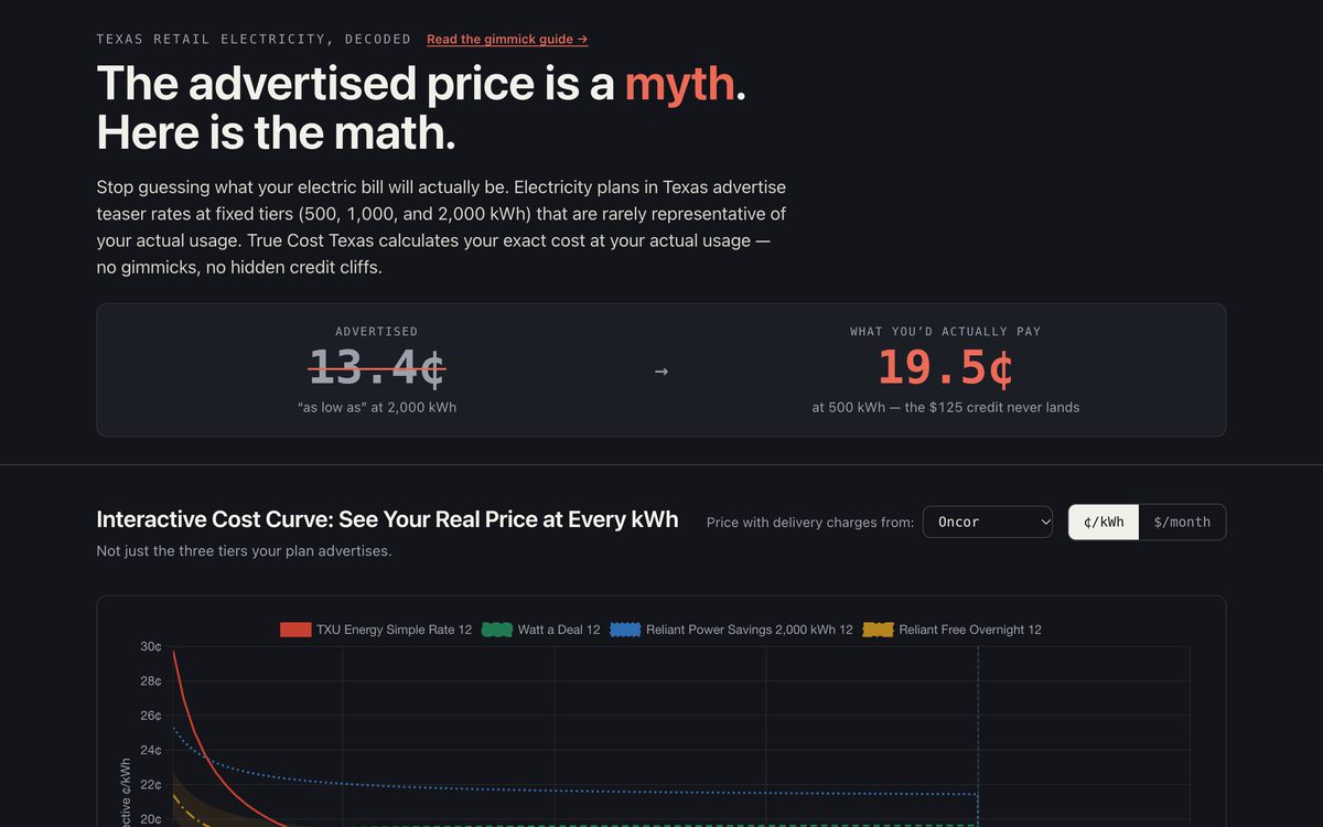
TrueCost Texas

Texas electricity plans advertise a price most people never pay. Upload a plan's fact sheet and TrueCost works out what you'd really pay at your own usage, checks its math against the plan's printed numbers, and points out the tricks — like a bill credit that disappears if you use a little less.

ReactTypeScriptPDF parsingCloudflare
→ truecosttexas.com

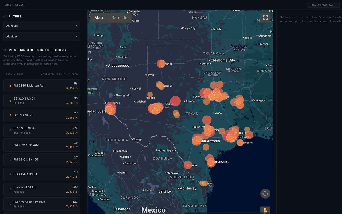
Crash Atlas: a list of the most dangerous Texas intersections beside a map with circles sized by crash severity
DATA MAP NOT PUBLIC YET

Texas Crash Atlas

Every crash in TxDOT's state records, matched to its nearest intersection and ranked by how severe the crashes were. Pick a city or a year to see which intersections are the most dangerous, then click one to see what happened there.

TxDOT CRISPostGISdeck.glGoogle Maps
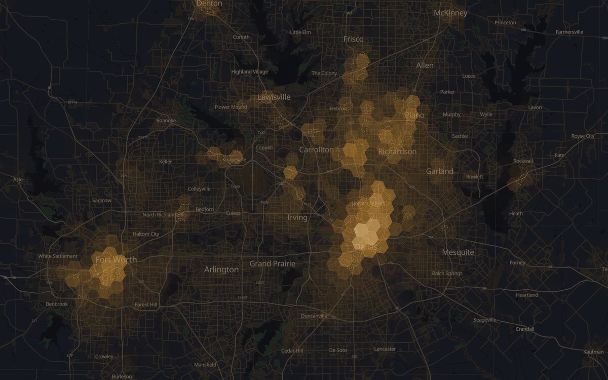
Cornerscore map of Dallas–Fort Worth: glowing hexagons are brightest in downtown Dallas, Fort Worth and Plano
DATA MAP NOT PUBLIC YET

Cornerscore

How easy is it to reach groceries, a good coffee shop, a park, or a bus from any corner of an American city? Cornerscore scores every 100-meter patch of every Census urban area, and sliders let you decide what matters most to you.

PythonDuckDBH3 hexesMapLibre
AI TOOLS OPEN SOURCE

MCP Servers for AI Assistants

MCP servers are plug-ins that let an AI assistant like Claude look up official public data and cite where each answer came from. local-dfw-mcp answers 14 kinds of local questions about Dallas–Fort Worth, from flood zones to school ratings. sdo-mcp gathers state population forecasts for 49 states into one place.

MCPNode.jsPythonPublic data

→ local-dfw-mcp  ·  sdo-mcp

03

Experience

79MILES OF I-35
TXDOT · GENERAL ENGINEERING CONSULTANT

I-35 Capital Express

Traffic projections and safety and operations reviews for TxDOT's I-35 Capital Express program, across Williamson, Travis and Hays counties.

VISSIMPredictive Crash AnalysisIAJR
→ Mobility35
671MILES ACROSS 25 COUNTIES
TXDOT · FEASIBILITY STUDY

US 287 Corridor Study

Ran the Texas Statewide Travel Demand Model to forecast future traffic along US 287 for the corridor's feasibility study.

Travel Demand ModelInteractive HTML Map
→ US 287 study
10+CORRIDORS A YEAR
TXDOT · TRANSPORTATION PLANNING & PROGRAMMING

Traffic Corridor Analysis

Corridor traffic analyses for TxDOT's planning division, following TPP's corridor analysis procedures.

Traffic Projection Methodology
→ TxDOT procedures
200K+VEHICLES A DAY
VDOT · TRAFFIC SIMULATION

495 NEXT

Traffic simulation of a 3-mile stretch of the Capital Beltway in Northern Virginia for the 495 NEXT express lanes extension.

VISSIMToll Diversion
→ 495 NEXT
2019ADOPTED BY CITY COUNCIL
5E'S FRAMEWORK: ENGINEERING · EDUCATION · ENCOURAGEMENT · ENFORCEMENT · EVALUATION

Georgetown Bicycle Master Plan

UT Austin master's project that became the citywide bike plan for Georgetown, Texas, adopted into the city's 2030 Comprehensive Plan. Made the proposed bike network map and a map rating how stressful each street is to ride on.

Master PlanPublic EngagementGIS
→ Bicycle Master Plan
LET'S WORK TOGETHER

Data That
Moves Everyone

Transportation planning, traffic engineering, web development, and AI tools. Let's connect!

SIDE STREETS